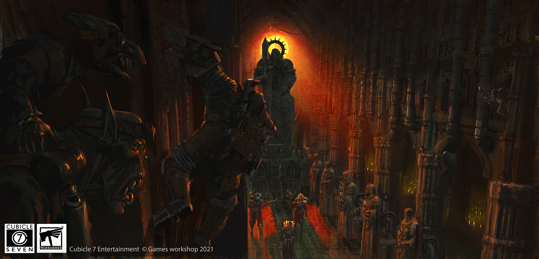
Thursday, 16 May 2013

Bronze Axe Sketches

Bronze Hafted Axe
Bronze Socketed Axe

Two more sketches from the Cork Museum in Fitzgeralds Park, Cork city. Today I just painted and drew axes, both are from the bronze age, but hafted in different ways. The upper painted one was an earlier form of hafting from around the early Bronze Age(2,500-1,500 BC) and the bottom pencil sketch is a socketed axe from the later Bronze Age(1500- 600 BC)

Wednesday, 15 May 2013

Irish Mesolithic Hunter


The illustration is of a Mesolithic Irish Hunter, from the early Mesolithic period, so between 8,000-6,000 BC. Mesolithic, for those of ye who dont know, in Greek mesos is middle and lithos is stone, so in Archaeological terms means middle stone age. A range of activities were used by Hunter gatherers in Ireland, both hunting and gathering as well as fishing, actually one of the strongest differences between Ireland and Britain at the time is the prevalence of fishing here.

The tools the hunter has here are reconstructions of what tools a Mesolithic person may have had, flint was mainly used at the time, as well as chert and would have been hafted in wood or bone. The axe head is from a flake flint axe, Mount Sandel, Co. Derry and the Knife head, from a chert knife, Caherguillamore, Co. Limerick. The cutting tool tucked diagonally into the fur wrapped around his waist, has microliths in it, which are a common find from the Mesolithic. Microliths are small pieces of flint, which are believed to have been combined in different ways to make different tools, in this case a cutting tool.  In Scania, Sweden, microliths were lodged into an arrow of pine wood, and glued in place with a resinous material.

The clothing is derived from a number of avenues; research, looking to other hunter gatherer peoples, and good old educated guesses. Clothing at the time was probably based on the natural shape of an animal, lessening the amount of work in making it, and pieces would have been stitched together using gut and sinew. The fur worn is from the animals that have been found in Irish sites, boar or wild pig and wolf. Feathers, teeth and shells have all been found in other cultures and times as forms of decoration. The feathers are based on birds that have been found in Irish sites; Cappercaille and Ducks. Evidence from the Mesolithic cementary in Denmark, Vedbaek, was that they wore teeth as ornaments, so the hunter here has teeth sown into his collar as ornament. The ladies of Teviec, found in Brittany, France, had necklaces made of shells, inspiring the bracelet of shells and also shells are sown across the front of the hunter's garment.

A special thanks has to go out to Robert Chapple for finding out about the ladies of Teviec for me.

References

1.  Clothing the Dry Bones: What People Wore in the Past - Elizabeth Wincott Heckett- Archaeology Ireland, Vol. 9, No. 2 (Summer, 1995), pp. 27-29
2.  The illustrated archaeology of Ireland-Elizabeth Anderson, Edited by Michael Ryan-Country House Dublin- 1991
3.  Last Foragers or First Farmers?- Aidan O' Sullivan- Archaeology Ireland, Vol. 11, No. 2 (Summer, 1997), pp. 14-16
4.  Life in the Trees: Mesolithic People and the Woods of Ireland-Graeme Warren-Archaeology Ireland, Vol. 17, No. 3 (Autumn, 2003), pp. 20-23
5.  Britain BC- Francis Pryor-Harper Perennial- 2004
6.  Early Ireland- Michael J. O'Kelly-Cambridge University Press- 1995
7.  The Prehistoric Archaeology of Ireland - John Waddell- 2010- Wordwell
8.  Pre-christian Ireland- Peter Harbinson- 1998- Thames & Hudson Ltd, London
9.  Ancient Ireland - Laurance Flanagan- 1998- g&m
10.  Seanda-Issue-5- National Roads Authority- 2010- Early hunter-gatherers by the Shannon- TJ O'Connell
11.  Special thanks to Robert Chapple for advice given

Tuesday, 14 May 2013

West Cork People Paper Article


My exhibition was mentioned in this months West Cork People, which was very nice of the paper. The exhibition is in its last week this week, from today to Saturday, 2-5 pm daily, so if your in the area make sure to pop in before it goes!

Thursday, 9 May 2013

Archaeology Card Collection


I have combined all 7 cards prints into one special deal, with money off as a collection. They can bought over in my shop:

http://jgodonoghue.storenvy.com/

Tuesday, 7 May 2013

Wedding Card Commission


 A commission for a wedding card, involving the couples names carved in Ogham into trees

Friday, 26 April 2013

Tríar Manach Commission

Tríar Manach

A commissioned illustration of the early medieval Irish joke 'Tríar Manach'-'Three Monks', which truly has stood the test of time. It was commissioned by Dennis King whose great translation is as follows:

"Three monks turned their back on the world. They go into the wilderness to repent their sins before God. They did not speak to one another for the space of a year.
Then one of the men said to another at the end of the year, “We are well,” said he

Thus it was for another year. “It is well indeed,” said the second man.

They were there after that for another year. “I swear by my habit,” said the third man, “if you do not allow me some quiet I will abandon the wilderness entirely to you!”"


More on this joke here:

http://www.smo.uhi.ac.uk/sengoidelc/donncha/tm/en/

Thursday, 25 April 2013

Sketches from Cork Museum

Microlith Cutting Tool

Flint Spearhead

The above are two sketches I made in Cork Museum yesterday, they are both reconstructions of mesolithic tools, the top one has small flint objects, called microliths, lodged in a piece of wood to form a cutting tool, microliths are quite a common Mesolithic find. The second is of a flint spearhead attached to a wooden shaft.

Monday, 22 April 2013

A Sense of Place Exhibition, Clonakilty


Name of Exhibit- A Sense of Place
Dates of exhibit- 1st - 18th of May
Venue- Clonakilty Community Arts Centre, Astna Square, Clonakilty, Cork
Website: http://www.jgodonoghue.com/

Information on the exhibition:

'A Sense of Place' is a solo exhibition by emerging Cork artist JG O'Donoghue, exploring the Irish landscape in Ink through the perspectives of language and archaeology. Focusing on placenames and prehistoric monuments and these two ways in which people have viewed, altered and interacted with the landscape. These respresent an attempt to humanise and shape the land of Ireland and in so doing express a sense of place. The making of megalithic monuments marked a turning point in landscape history, this was the time man went from merely inhabiting the land, to altering and adding to it substantially. They were our first permanent structures, so these monuments mark the first enduring connection between man and place, our first known sense of place. Placenames are the most immediate connection between people and place, language being the medium in which we connect our inside self with the world around us, by naming the landscape we make the outside world part of our inside self, marking another sense of place. A sense of place is like other senses it's hard to define but innate and integral to people's identity and sense of belonging. The pasts people used the landscape as a medium, the naming of it or marking it with monuments were the ways in which they expressed their sense of place and it is this which this exhibition explores.

FB Event: https://www.facebook.com/events/151843224986568/

Sceitsí ón Gaeltacht


An Triúr Deirféar

An Blascaod Mór
A couple of Sketches from a trip over the weekend to the Corca Dhuibhne Gaeltacht in West Kerry. The first is from the peak of Binn Diarmada in An Triúr Deirféar or the Three sisters. The second is of Blascaod Mór from the Ionad an Bhlascaoid/Blasket Centre, unfortunately there was a storm brewing over the weekend so the boat wouldnt go out.

Cupla Sceitsí ó turas i rith an deireadh seachtaine seo caite i Corca Dhuibhne Gaeltacht i iarthar Ciarraí. An chead Sceitse ón 'Binn Diarmada' i 'An Triúr Deirféar'. An Dara sceitse de 'An Blascaod Mór' ón Ionad an Bhlascoid, ach bhí storim ag teacht mar sin, ní rabhamar abalta a imeacht ann.

Thursday, 11 April 2013

Mount Sandel Mesolithic Hut


Mount Sandel Mesolithic Hut

Mount Sandel is the earliest known domestic habitation in Ireland and according to Francis Pryor, in Britain also. Its from the early Mesolithic period with dates of around 8,000 BC and occupation of the site may have lasted 500 years. It is situated on a 30m high bluff  overlooking the river Bann and is just south of Coleraine in co. Derry. The opinion of the excavator, Peter Woodman, was that these werent the first colonists but had been in Ireland for some time previous to living here.

There was several huts found, but it is believed that only one was in use at any one time. One of the theories on the huts construction was that they thrust saplings into the ground and bent them at a 60 degree angle creating an oval shape, and then tied them in the centre together. After this, they may have weaved other lighter branches between the saplings to support them. The huts were about 6 metres accross and the roof could have been covered with reeds or skins or even earthen sods, here I choose skins.

It is believed that it was occupied by no more than 10 people at a time, or could have been as little as 3 and some argue that it was inhabited all year round. It looks like the inhabitants had a varied diet, eating a variety of wild plants as well as birds but the main remains were that of wild pig and fish.You will notice the dog, at the site there was the remains of either a wolf or a dog, around the same time Starr Carr in Britain has shown remains of a domestic dog, and are known from elsewhere in Europe, so quite possibly it was a dog. So there you have it, dogs have been in Ireland as long as people, perhaps we should be asking them for permission to live here!

References:

1. The illustrated Archaeology of Ireland- Michael O'Connell, Peter Woodman-Country House Dublin- 1991
2. Last Foragers or First Farmers?- Aidan O' Sullivan- Archaeology Ireland, Vol. 11, No. 2 (Summer, 1997), pp. 14-16
3. Life in the Trees: Mesolithic People and the Woods of Ireland-Graeme Warren-Archaeology Ireland, Vol. 17, No. 3 (Autumn, 2003), pp. 20-23
4. The illustrated Archaeology of Ireland- Michael Ryan, Peter Woodman-Country House Dublin- 1991
5. Britain BC- Francis Pryor-Harper Perennial- 2004
6. Early Ireland- Michael J. O'Kelly-Cambridge University Press- 1995
7. The Prehistoric Archaeology of Ireland - John Waddell- 2010- Wordwell
8. Pre-christian Ireland- Peter Harbinson- 1998- Thames & Hudson Ltd, London
9. Ancient Ireland - Laurance Flanagan- 1998- g&m

Tuesday, 2 April 2013

Ballyglass Neolithic House


Ballyglass is a Neolithic house which was discovered during excavation of the Ballyglass Court tomb in Co. Mayo, dated according to Waddell to the 2nd half of the 4th millenium BC. It was a rectangular house which measured about 13m long by 6m wide and was orientated southeast to northwest. The majority of the house had walls made of upright split oak planks like the Ballynagilly neolithic house I illustrated previously. Ballyglass mightnt have been a living or sleeping house, it could have been a dinning hall or feasting area, which is what I intepretated it here as. It also didnt seem to have a doorway, instead the entrance was on the north western end and it was theorised by the original excavator as a porch area. This seemed to have had an area screened to channel people into a passage in the side of the house leading to the main room. The screen was made of a small section of upright planks and then maybe a wattle screen after. I presumed that the porch area that wasnt part of the channel was covered with wattle and daub to block it off. The porch area also was thought, according to Eoin Grogan, to have enough post holes as to be load bearing so there could have been a second floor which would probably have been used for storage, as shown here.

The roof could have been either gabled or hipped, here it is shown as the latter and the roof was supported by a series of posts, which were the main structural elements of the house. The house had two areas of fire reddened clay which probably were hearths, one in the main room and the other in a secondary room in the back, with smoke holes at the top of the roof in order to leave out some of the smoke. The back little room in the south eastern corner, shown here in the far left, had some of its walls that were like the rest of the house of split oak construction, while other parts had less substantial walls which may have been, as it was theorised by the excavator Seán Ó Nualláin, light moveable screens, shown here as a wattle screen. I thought this room too small for sleeping and perhaps with a moveable screen not warm enough for it either, but yet the room had a hearth so couldnt just be for storage. So I assumed that this was a cooking area, hence the pig on a spit shown here. The screens then could have been moved to take advantage of natural light when available and closed when its dark. The food cooked here could then be brought into the main room or perhaps dinning hall, where it could be consumed by the fire. The roof of the small back room was supported by posts outside the long walls, which the excavator theorised represented stays.

Outside is where the majority of production of tools and pottery would have taken place in prehistoric times, taking advantage of the natural light. Here three people make pottery outside, it shows the various processes in pottery production; one makes pottery with a technique known as coiling, which involves using a continious snake of clay to shape the piece. Another uses the pinching technique to shape a ball of clay into its required shape by pinching the clay. Another person uses a sharp tool in order to ingrave the shaped pots with decorations. After these stages the pottery would have been fired, this was done by being left close to the fire for a day. During which they would have been moved closer and closer as the day wore on, eventually ending up ontop of the fire.

References

1. The illustrated archaeology of Ireland- Eoin Grogan, Edited by Michael Ryan-Country House Dublin- 1991
2. Landscapes of Neolithic Ireland- Gabriel Cooney-Routledge- 2005
3. The Prehistory of Britain & Ireland-Richard Bradley-Cambridge University Press,2009
4. The Prehistoric Archaeology of Ireland - John Waddell- 2010- Wordwell
5. Early Ireland- Michael J. O'Kelly-Cambridge University Press- 1995
6. Pre-christian Ireland- Peter Harbinson- 1998- Thames & Hudson Ltd, London
7. A Neolithic House at Ballynaglass-1972-  Seán Ó Nualláin- The Journal of the Royal Society of Antiquaries of Ireland

Wednesday, 13 March 2013

Exhibition in the Bishopstown News


My ongoing Exhibition was mentioned in the Bishopstown news again this month, which was very nice of the paper. The exhibition will continue till the end of March and is in the Bishopstown Library, right outside Wilton shopping centre, so plenty of time left for people to see it!

Friday, 8 March 2013

Photos from the Opening Night


Photos from the opening night of 'A Sense of Place' my solo Exhibition, the exhibition will continue for the month of March, so if your in the Cork area make sure to check it out!

Tuesday, 5 March 2013

Stone Row Card Print Collection


A collection of 4 card prints of my work, featuring 2 stone rows, a standing stone and a stone pair. Its available as 4 for the price of 3, found in my shop:

https://www.etsy.com/listing/125490793/stone-row-card-print-collection-4-for

Monday, 4 March 2013

Exhibition in Evening Echo


My ongoing Exhibition was mentioned in the Evening Echo again on Friday. The opening night for the exhibition will be this Thursday, the 7th, at 6:30 pm, if you would like to come there will be wine and some speaking at the event. If you cant make it, the exhibition will continue for the month of March inside the gallery space in the Bishopstown Library, Cork.

Friday, 1 March 2013

Exhibition in the Cork News


My current exhibition, that just started today, was mentioned in the Cork News today. It will be continuing for the month of March in the Bishopstown Library. The opening night for the exhibition will be next Thursday, the 7th of March, at 6:30 pm, where there will be wine and talks etc. Look forward to seeing some of ye there.

Special thanks goes out to Maria Tracey and Cork news for mentioning my exhibtion and getting the word out, thanks!

Thursday, 21 February 2013

A Sense of Place Exhibit


Name of Exhibit-A Sense of Place
Opening Night-7th of March 6:30 pm
Dates of exhibit-1st - 30th of March
Venue-Bishopstown Library, Wilton, Cork City
Opening Hours-10 am - 5:30 pm

 Exhibition Info: 

'A Sense of Place' is a new solo exhibition by emerging Cork artist JG O'Donoghue, exploring the Irish landscape in Ink through the perspectives of language and archaeology. Focusing on placenames and prehistoric monuments and these two ways in which people have viewed, altered and interacted with the landscape. These respresent an attempt to humanise and shape the land of Ireland and in so doing express a sense of place.  The making of megalithic monuments marked a turning point in landscape history, this was the the time man went from merely inhabiting the land, to altering and adding to it substantially. They were our first permanent structures, so these monuments mark the first enduring connection between man and place, our first known sense of place. Placenames are the most immediate connection between people and place, language being the medium in which we connect our inside self with the world around us, by naming the landscape we make the outside world part of our inside self, marking another sense of place. A sense of place is like other senses it's hard to define but innate and integral to people's identity and sense of belonging. The pasts people used the landscape as a medium, the naming of it or marking it with monuments were the ways in which they expressed their sense of place and it is this which this exhibition explores.

Wednesday, 20 February 2013

Bweeng/Na Boinn, wedge tomb/tuama Dingeach


Not far from the tiny village of Bweeng, on the eastern hills of the Boggeragh mountain range is this wedge tomb. The tomb rests on the north slope of a little hill about 260 metres high, which has the river Glashaboy/An Ghlaise Bhuí just north of it, and the stream Cummeen/An Coimín to the south of it. Gazing from the tomb east you can see the glens softly undulating and small meadows stretching out between it and the Nagles hills in the east and looking north and west you are greeted with views of large lumps rising up which are Boggeraghs. According to Ó Donaill the name 'na Boinn' (which Bweeng comes from) is the plural of Bonn which is sole, so my guess is the name would translate as "the soles", perhaps suggesting the soles of the mountains which this hill marks the eastern side of or maybe that a part of this area is shaped like the sole of a foot.

 The Tomb is situated on a country road which if you were coming from the north is the last turning on the R619 before you come into the town of Bweeng. You can see it clearly from the country road, its essentially two fields up on a small dirt track beside a house on the left hand side. The tomb is quite huge actually, making me think perhaps its related to the nearish 'Labbacallee wedge tomb' which is further north near Glanworth. Unfortunately while the northern part of the tomb is still erect, the southern part has collapsed and been covered in grass, making it lopsided, but judging by what is there, it must have been truly impressive sight in its day. As said previously the views from this tomb both East, West and North are great but the views south are obstructed by the Hill it is on, so perhaps it is the other directions which are the focus of this tomb.

Perspective plays a big part in how we view the landscape we inhabit, a persons age, gender, professional or their social position all alter the way they view the landscape, as some have said, there is never one landscape but many. One must remember when viewing landscape we are continually changing it, by just looking we alter and re-interpret it, it is never just left alone, both of these points were as true back in prehistoric times as it is now. When we put something before us in nature, whatever is, like the jar in Wallace Stevens poem 'Anecdote of the Jar', it transforms the wilderness around it, even tames  it, it makes the vastness of nature compact and more easily understandable to us. Perhaps the same perspective was what the megalithic builders were doing, by placing a tomb in nature, they were taming it, transforming it. Just as a path or the main subject in a painting focuses the eye, so too does a megalithic monument. It is ideas like these which is one of the more interesting aspects of Megalithic culture, even though we can never truly divorce ourselves from our own time and culture, I believe these people have the most to teach us in the trying, as they are the most different, most alien from us. 

Monday, 18 February 2013

A forgotten Sketch- Inchinlinane Gallán

Inchinlinane Gallán

Seems I forgot to post this when i did it, this is a gallán or standing stone outside Macroom in west Cork, from the September 2012 Sceitse trip

Sceitsí Sceitse

Donoughmore Church

Rylane Gallán

Two sketches from trips I have done with the sketch adventuring group 'Sceitse'. Both are from our trip in January, where we explored between Blarney and the southern slopes of the Boggeragh mountains in North Cork. One is Donoughmore Church in the centre of Donoughmore village, in the churchyard we were told that there was a mass grave from the famine, with 1400 people buried inside, including one local priest. While the other is Rylane Gallán, a standing stone just outside Rylane village, in the field beside it there was also a lovely 5 stone circle.

Wednesday, 13 February 2013

Bishopstown News Article


My upcoming exhibition for the month of March was just mentioned in this months Bishopstown News newspaper. They actually got the dates slightly wrong, it starts on the 1st of March but the opening night is 7 days later on Thursday the 7th of March at 6:30 pm, if your in the area make sure to pop in. It takes place in the Bishopstown Library's Gallery space on the second floor of the library,  which is just beside Wilton shopping centre in Cork city. My sincerist thanks goes to Bishopstown News for announcing the exhibition.

Monday, 11 February 2013

Lackaduv/An Leaca Dhubh, the "turtle", wedge tomb/tuama Dingeach, Near Macroom, Cork


Two roads after the R582 between Macroom and Millstreet on the slope of a hill is this unassuming monument. Its situated on the last turning left before the signed Scrahanard megalithic complex if your coming from the Millstreet direction. Lackaduv is actually the name of the 303 metre high hill which this wedge tomb sits on its northern slope in a field by the road. Lackaduv is from the Irish 'An Leaca Dhubh', Leaca according the Flanagans (Irish Place Names 2002) means flat sloping surface, like a cheek ( can also mean human cheek), describing a type of hill, so lackaduv would probably translate as the flat black sloping hill. The glen below this monument is from the tributaries of the Awboy river that have cut into the mountains feeding the main course of the river. The hill is on one of the south west slopes of  the Boggeragh mountains, further to the west you get the start of the Derrynasaggart mountains, but not much of that is visible here with the main focus on the start of the Boggeraghs, which this little tomb seems to point to.

This tomb is usually called Lackaduv 2, as there is another Lackaduv wedge tomb on the southern slope of this hill (which I did a drawing of previously). Lackaduv 1 is actually just accross the road from the Scrahanard megalithic complex, which contains a wedge tomb, cairn and standing stone. So this area is rich in prehistoric monuments as is the whole greater mid north west Cork area. I have to say this is one of my favourite tombs, as it is tiny, the smallest I have seen, probably less than a half a metre in height but it has such a strong character. It has an appearance of a turtle waddling along in the grass, making me think it should be nicknamed "the turtle". Besides the unusual look of the tomb, there is also a magnificient view from it, with the glens unfolding below and the Boggeraghs towering above. Not many of the support stones are visible in the tomb, making me think that some had been covered by earth, also on its east side, the tomb has unfortunately collapsed.

The megalith builders would have had access to fast transport via rivers and seas, which were the highways of their day, but for the majority, life would have been pedestrian, mostly lived within walking distance. This would have imbued the landscape around them with so much more meaning, as they were exactly the same biologically as we are now, but our attention is much more dispersed, being often more aware of the wider world than our local. Also all that time and energy we spend reading books, on the internet, watching tv, all that active mental power would have been spent locally and in their social groups by them. Landscape has been found in some oral cultures to be both memory and history for that culture, hard for us to imagine as the landscape is more of a background to our daily activities and our human constructions these days. These stone monuments must have been amazing features, in a world without permanent knowledge like writing, these eternal things, made of the building blocks of the earth, must have been reminders of their heritage. In the past the landscape would have been a much different experience, now its mostly farms and fairly open, back then, it would have been thick with dense forests with these monuments standing out strongly in patches of forest clearance.

Tuesday, 5 February 2013

Inchincurka Wedge Tomb/Inse an Choirce Tuama Dingeach


On the R585, or as its known in locally as the "back road to Bantry", just beyond Shanlaragh as your heading for the Cousane Gap between the Maughanaclea Hills and the Shehy Mountains, sits this monument in a field right next to a T junction. Its on relatively flat field which offer modest views of the Shehy Mountains rising up to the west, as the Cummernamart river snakes up north past it, the entrance to this tomb points to both but its most likely the mountains which its focus is. This part of west Cork is littered with monuments, quite a few others on the eastern foothills of the Shehy mountains which offer beautiful views of Bantry Bay beyond. The name of the townland is Inchincurka, 'Inse an Choirce' in its original Irish,which Ó' Donaill has 'Inse' meaning  'water meadow',  while P.W. Joyces elaborates it as 'a low meadow along a river'. The other part of the name is 'Coirce' which are 'Oats', so a translation may be 'water meadow of oats'.

The tomb itself is nicely overgrown, alot of the interior has been engulfed by plants, and the northern side is nearly entirely invisible under it, from that angle it looks almost like a bat with the two portal stones giving the appearance of ears. The tomb itself is a great example of a wedge tomb as you can quite clearly see the wedge shape which gives these tombs their name. Looks like there is some double walling too which can be seen in other wedge tombs like Labbacallee, Island or Knockagoun. Often these sort of tombs are called 'Leaba' in Irish, which can be short for 'Leaba Dhiarmada is Ghráinne' or 'Diarmuid and Gráinne's bed'. They were said to have been made by Diarmuid and Gráinne as nightly beds in their long flight from Fionn's and the Fianna's wrath after they ran away together.

The megalithic builders were the first to alter the landscape, as Gabriel Cooney points out, it was they who first farmed with cereal, reared cattle, and cleared the land. We dont think about it these days as its so normal now, but it must have been a revolution in thought, as what they were doing was controlling nature. By extension this must have made them have a greater sense of place and of belonging, as they were not just dwellers in the land but an active players in its system. While most of the alterations they made back then were temporary; a cow dies, a tree will regrow etc, there was one thing that was permanent though and was their tombs. These were mans first permanent statement  to the ages, but what what were they saying? I suppose we will never know for sure but I personally believe the answer is there when you visit these places.  When your at the site and if you look up, and gaze at what is around you, you are often blown away by a magnificient view that greets you. So for me unlike modern religions where they say "Look at us", look mans achievements with their buildings, I feel what they were saying is "Look at this" look at nature in all its glory.

Thursday, 31 January 2013

Gleann


Gleann is essentially a glen or valley, interestingly, according to P.W. Joyce the English word 'Glen', also used for valley, does not derive from the Irish Gleann, or vice versa, that it was previously in Anglo Saxon and was in Old Irish far before the coming of the Normans. My guess it could be they are both from Welsh, since in Welsh it's Glyn or perhaps they all share an indo-European root or another possibility it come from the influence of Irish missionaries christianising the Saxons, in other words, who knows! According to Joyce there are over 600 places in Ireland with the name Glan or Glen (which he points out are the anglicisations of Gleann) and the name is found in every county throughout the land.

The Gleann shown here is 'Glenmacnass' or in Irish ' Gleann Log an Easa' which according to Room translates as 'Glen of the hollow of the waterfall'.   This Gleann is often mentioned in Geographic books as its kind of the epitomy of a U-Shaped Valley. You can see clearly when you are there, the U shape of the Glacier that cut its way slowly through this gleann, previous to that it would have been what they call a V shaped Valley, which are created by rivers. This one was probably created by the river shown here on the right, which derives its name from the Gleann, as its known as 'Glenmacnass River'. 

Placenames are part of our identity, part of a living landscape, as Patrick Sheeran has said, if we were to visit Ayers Rock in Australia, it would seem like a nice geographic feature but not much more. But to the Aboriginals each area, each gap or rock has a name, knowing them conjures up stories and myths in their minds. The same would have been true here in ancient times, as Tim Robinson points out for the Celts, each gleann, forest, or mountain was inhabited by wonder and myth. Similar would have been true for the later Gael as Daniel Corkery puts it: " Those O'Connells, O'Connors, O'Callaghans, O'Donoghues, all the Gaels were one, it may be maintained, with the very landscape itself... to run off the family names connected with one of those houses was to call to vision certain districts hills, rivers and plains; while contrariwise, to recollect the place-names in certain regions was to remember the ancient tribes and their memorable deeds." So one can see how placenames are tied to a peoples sense of place and even further, they are part of their identity and the living landscape which they inhabit.

References

1.    Irish Place Names- Deirdre Flanagan & Laurence Flanagan- Gill&MacMillan- 2002
2.    An Irish-English dictionary, J. O'Brien, 1832,
3.    Irish names of places, Vol 1, P.W. Joyce
4.    Irish local names explained Vol1, P.W. Joyce, 1902
5.    Folclóir Gaedhilge agus Béarla, Rev. Patrick S. Dinneen, 1904,
6.    'Dictionary of Irish Place Names', A. Room, 2009
7.    OSI Discovery Map 56. 2001
8.    The Kingfisher Geography Encyclopedia, 2001
9.    The Dorling Kindersley Illustrated Factopedia, 1995
10.    Genius Fabulae: The Irish Sense of Place, Patrick Sheeran, 1988
11.    Listening to the Landscape, Tim Robinson, The Irish Review, No. 14, An Ghaeilge: The Literature and Politics of Irish(Autumn, 1993), pp. 21-32
12.    Landscape and western Art

Wednesday, 23 January 2013

Loch

Acrylic Ink on Arches 100 % Cotton Cold pressed paper,
10 x 7 inchs
.
Loch is a lake, can also be a sea inlet or a pool according to Dineen, it is still most commonly a lake, which is defined by the Kingfisher Geography Encyclopedia as a large body of water surrounded by land,  finally loch is 'Lacus' in Latin and 'Llyn' in welsh.  The word Loch is used in Ireland and Scotland, while in Ireland it tends to be anglified as Lough, in Scotland the original Irish spelling is kept, Loch. Most lake names in Ireland use the word loch like Lough Leane in Killarney, which P.W. Joyce says the Dinnshenchas claims its from Lean of the white teeth, a craftsman who forged on the shore, probably highly fanciful but always fun to get the imaginative too.

The painting is of one of the two Sgillogue lochs in the Comeragh mountains in county waterford, nestled between Coumlara and Coumguarha, its a beautiful part of the mountains with views of the Nire Valley below. These lochs are two little cirque (Com in Irish, hence Comeragh mountains), which are hollows created during the forming of a glacier. There are several other kinds of lakes, some are those formed after tectonic plates move, others are in craters, and others are called Oxbow lakes and are formed when a part of a river gets cut off from the main course.

What we dont realise usually, is that language is a bridge, its the bridge we build when we want to connect the inside itself, with the outside world. A language is shaped by the history of a people, each generation trying to express both what was around them and what was in them and connect the two. Placenames are an embodiment of this, they are the bridge between our landscape and language, both of which we use as mediums. This is true for all cultures, as much for French or German as Irish, language and the world around it, have changed and grew together, making the experience of either without the other, only half the story.

Bibliography

1.    An Irish-English dictionary, J. O'Brien, 1832,
2.     Irish names of places, Vol 1, P.W. Joyce
3.     Irish local names explained Vol1, P.W. Joyce, 1902
4.     Folclóir Gaedhilge agus Béarla, Rev. Patrick S. Dinneen, 1904,
5.    OSI Discovery Map 75
6.    The Kingfisher Geography Encyclopedia, 2001
7.    The Dorling Kindersley Illustrated Factopedia, 1995
8.    Listening to the Landscape, Tim Robinson, The Irish Review, No. 14, An Ghaeilge: The Literature and Politics of Irish(Autumn, 1993), pp. 21-32Reviewed
9.    "Before I Forget…": Seán Mac Labhraí, Journal of the Poyntzpass and District Local History Society, No.3 (Nov., 1989)

Thursday, 20 December 2012

Ballynagilly Neolithic House


Nestled on a hill in the townload of Ballynagilly now 8 km west of Cookstown in co. Tyrone was a neolithic house, which the illustration is a reconstruction of. To its west on the south east edge of the Sperrin mountains is Oughtamore with the Beaghmore megalithic complex, to the north, Fir mountain, beyond which is the court cairn of Carnanbane, to the south east Killy curragh rock overlooks Lough Neagh and south east is Feregarron wedge tomb.  It is here 6 thousand years ago, a house was built and the forest around it cleared, creating an open grassland that lasted here till the middle of the 3rd millenium BC.

The house was dated to the period of 4340-3790 BC, was almost square at 6.5m x 6m and orientated east-west. Its north and south walls had parrallel trenches in which planks of radially split oakwood were placed upright, filled in with packing stones, a type of walling well known in central Europe, while the east and west walls were probably of wattle and daub construction. Postholes of the interior were less clear in their remains, while the south side was mostly intact, the north walls posts werent as obvious, so I had to look at similar sites, like Tankardstown, to fill in the gaps, and presumed for balance sake that the north mirrored the south, as it did with the trenches. There was also 2 posts in the centre of the building, probably acting as roof supports.

Inside the house there were two hearths, one was probably the fireplace while the other may have been the remains of an oven (shown in the accompanying illustration). At the site was found flint flakes, arrowheads, stone axes, and Lyles hill neolithic pottery along with animal bone. To the south of the house was a pit in which clay may have been taken for use in daub, in the illustration the two individuals outside the house are making wattle and daub, with one person mixing the daub by threading with his feet, while another applies it to some wattle.

References:

1. Pre-christian Ireland, Peter Harbison, 1998
2. Early Ireland, Michael J. O'Kelly, 1995
3. The Prehistory of Ireland, John Waddell, 2010
4.  An Early Neolithic House in Co. Tyrone- The Journal of the Royal Society of Antiquaries of Ireland, Vol. 99, No. 2 (1969), pp.165-168
5.  Palaeoecological Investigations at Ballynagilly, A Neolithic and Bronze Age Settlement in County Tyrone, Northern Ireland -  Philosophical Transactions of the Royal Society of London. Series B, BiologicalSciences, Vol. 286, No. 1013 (Jul. 10, 1979), pp. 345-369
6. Palaeoecological Investigations at Ballynagilly, A Neolithic and Bronze Age Settlement in County Tyrone, Northern Ireland
7. ‘An Early Neolithic House in Co. Tyrone’, Journ. Roy. Soc. Antiq. Ireland, 99 (1969)
Mt. A.M. ApSimon, Department of Archaeology, University of Southampton

Thursday, 13 December 2012

Bearna


Bearna is the Irish word for a gap or chasm, usually a mountain gap or a gap through high land. Often this word appears in placenames and is commonly anglified as Barna. The particular Bearna drawn here is 'Bearna an Choimín' or better known for its English name 'the Gap of Dunloe', near Killarney in Kerry. Bearna are formed because of glacial processes, mostly in Ireland they were formed in the Ice ages. All glaciers originally start high up in the mountains, in hollows or cirque (called 'Com' in Irish) facing north-east where the snow melts slower because of less sunlight. When snow builds up more than it melts the snow ice crystalises from the compression turning the snow hard and blue into what is known as a firn. Once the firn reaches a depth of around 30 metres, gravity forces the ice out of the Com or cirque down to the glen below. Freeze thaw action causes more stones to fall into the glacier giving it teeth in which to tear at the landscape, reshaping it in the process. As long as more snow is added than lost the glacier will continue to edge forward. The Gap of Dunloe was formed in a similar way, when a glacier created in a high up in a Com or Cirque, crept out of its birth and cut its way accross a ridge, deepening it and creating the Bearna.

In some ways placenames, like so many aspects of Irish culture, reflect our history. There are placenames from each culture that have come here, from Viking Old Norse to Norman French to Colonial English.  Placenames even feature heavily in our early mythology for instance a big part of 'Agallamh na Seanórach', a book about the Fianna and St Patrick, is about placenames. There was even a strand of medieval Irish poetry about placenames called 'Dinnshenchas'. So there has been a long  facination in this culture with placenames, either in the naming of it, and so laying claim to it for whatever purpose, to the use of placename as a way of illustrating and enlivening a myth or poem. Perhaps this is what makes placenames so facinating in this country, learning and exploring them often teaches you alot about our culture and history but also can contain great tales, full of  imagination.
 
References

1.  Joyce, P. W. The origin and history of Irish names of places. Volume 3, 1920.
2.  Joyce, P. W. The origin and history of Irish names of places. Volume 1, 1920.
3.  FOCLÓIR GAEDHILGE AGUS BÉARLA- Patrick Dinneen
4.  Irish Place Names- Deirdre Flanagan & Laurence Flanagan- Gill&MacMillan- 2002
5.  Folclóir Gaedhilge agus Béarla - An Irish-English dictionary, being a thesaurus of the words, phrases and idioms of the modern Irish with explanations in English (1904)
6.  An Irish-English dictionary (1832)- J. O'Brien
7.  From Foclóir Gaeilge- Béarla, Niall Ó Donaill
6.  Cork and Kerry Townlands Names in Irish and English- An tOrdú Logainmneacha (Contae Chorcaí seachas ceantair Ghaeltachta) 2012
7.  Planet & People- leaving certificate geography- Sue Honan & Sue Mulholland
8.  The World Book Encyclopedia of Science- The Planet Earth
9.  The Kingfisher Geography Encyclopedia, 2001
10.  The Dorling Kindersley Factopedia, 1995
11.  Reading the Irish Landscape- Frank Mitchell & Michael Ryan, 2003

Sunday, 2 December 2012

Knockadoon Neolithic House, Lough Gur


Lough Gur, one of the most historical places in Ireland, where there is history and archaeology from every era, from Neolithic settlements to Bronze age farms, from wedge tombs to Iron age forts, from early medieval crannógs to medieval castles, Lough Gur is one of the most important sites in Ireland. Every era laid claim to this small C shaped lough in co. Limerick, its limestone land was and still is fertile land for farming or pastoring, even in winter its sheltered valleys can provide warmth. Knockadoon is a hill within Lough Gur, between the two arms of the C, it is here on this hill that one of the oldest settlements in Ireland is, the Neolithic settlement is slightly elevated with the lake in the background. These days this hill only has water on three sides, back then it would have been surrounded on all sides with water, providing ample protection for its inhabitants.

One of the houses there, called Site A(which the above cut-away house is a recreation of) , was excavated in 1939 by S.P. Ó Ríordáin, dated to around 6,000-6,300 years ago it was a large rectangular house, 10m x 6m in size, with six rows of posts. The outer pair, on each side, formed the walls with a stone foundation, these posts held in place a fill of sods ontop of the stone footing. There was also two other internal rows of posts supporting the roof, with rafters ontop of them and then purlins to steady the rafters, finally with a thatch roof over it. These internal posts also divided the house in three, there was a central area with a hearth directly on the earthen floor, part of the central area was paved with stones, perhaps an entrance. This central area is probably where the main daytime activities took place, the house would have been constantly filled with smoke but while bad for the lungs the smoke did seep through the thatch and kill any insects living inside. The other two areas were probably for storage and sleeping quarters, with the entrance in the south west corner of the house.

Friday, 16 November 2012

Glaisín


Glaisín is the Irish word for little stream, in English it could be pronounced as Glasheen, and it is this spelling which is often used in Anglicised Irish place names. Glaisín comes from Glais, which means stream, in Irish an 'een' sound (spelt 'ín') is added to make something smaller, many Hiberno English words with 'een' in the end come from this.  Rivers are the most glorified of water systems, but even the widest once started as small streams, in Ireland 135 millions years ago, chalk deposits were laid down while Ireland was submerged in warm water, after Ireland rose out of the sea it was weathered and eroded, this is when the first streams were formed, which later still, became the rivers we know today. These days streams are formed up high, in mountains and hills, mostly in Ireland they start, from what else, but rain (sometimes melt from snow and ice as well but thats not as fun to complain about), as it rains the water is absorbed into the ground via cracks, eventually this water builds up over time until it then pours out forming a spring. Next gravity kicks in forcing the water down towards sea level, causing the water to trickle down forming streams, over many years these streams then erode their beds, forming rivers.

Landscape art and placenames have alot in common, one represents a selection of an area of land in a visual form, another in a verbal and literary form. To make land into landscape we have to focus on a particular part, land can cover many kilometres, too much for one viewing. So when an artist decides what is good in a land, what to turn into landscape, we are focusing on one aspect of the countryside which we think is more interesting than others. Placenames perform a similar function, showing what was and is worth focusing on, marking an area out, and drawing attention to it in order to show a landscape.  Exactly like with Glaisín, the people who made the placename were right, as this little stream, even after all the human additions around it, it is still the nicest part of the area, and the place most worth focusing on.


References

1. Joyce, P. W. The origin and history of Irish names of places. Volume 3, 1920.
2. Joyce, P. W. The origin and history of Irish names of places. Volume 1, 1920.
3. FOCLÓIR GAEDHILGE AGUS BÉARLA- Patrick Dinneen
4. Irish Place Names- Deirdre Flanagan & Laurence Flanagan- Gill&MacMillan- 2002
5. Folclóir Gaedhilge agus Béarla - An Irish-English dictionary, being a thesaurus of the words, phrases and idioms of the modern Irish with explanations in English (1904)
6. Cork and Kerry Townlands Names in Irish and English- An tOrdú Logainmneacha (Contae Chorcaí seachas ceantair Ghaeltachta) 2012
7. Planet & People- leaving certificate geography- Sue Honan & Sue Mulholland
8. The World Book Encyclopedia of Science- The Planet Earth
9. The Kingfisher Geography Encyclopedia
10. Reading the Irish Landscape- Frank Mitchell & Michael Ryan